A Lasting Blossom
Creating a new experience in a historical landscape, defined by a testament to our future through a harkening to our past
The United States capital faces a similar fate to most coastal cities considering sea level rise, one particular monument in Washington DC is already seeing the drastic effects of these changing tides; the beloved Tidal Basin and Cherry Trees. Tasked with designing a remedy for the drowning of this area that is soon to effect the city as a whole, a socio-infrastructural overhaul is proposed.
Existing Conditions
Permeability
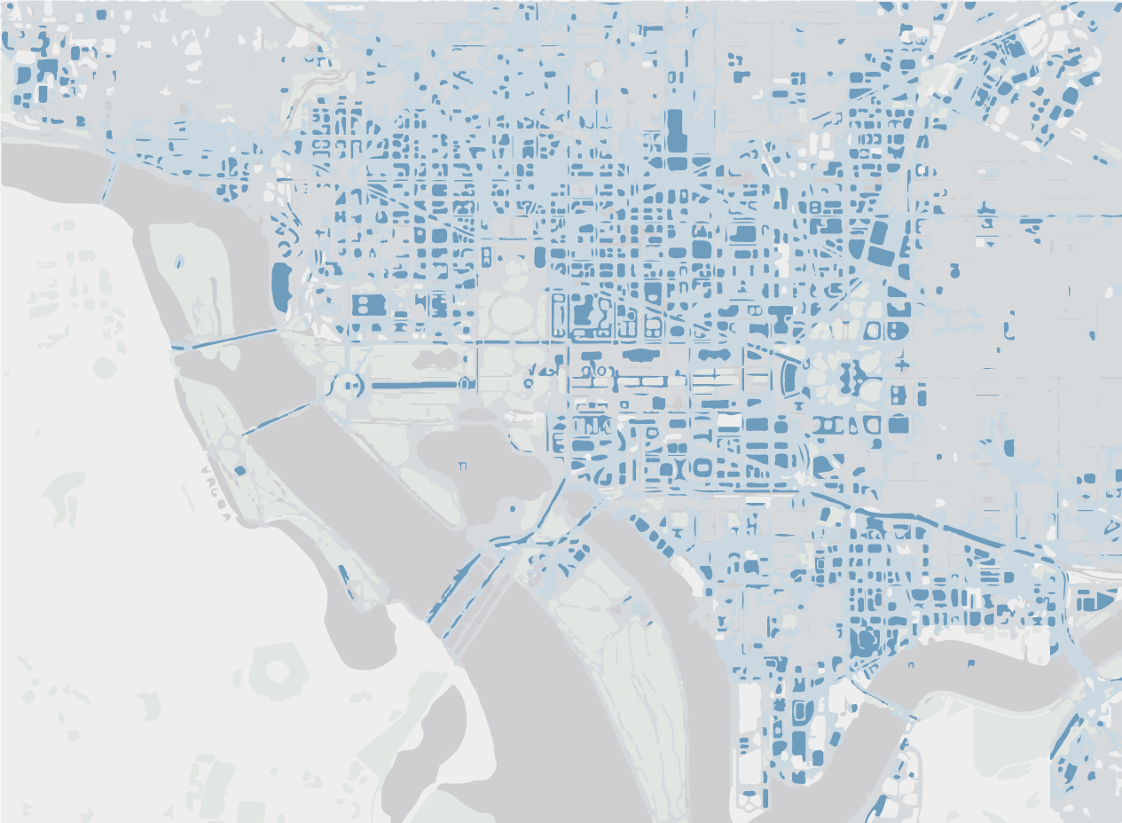
By looking at the hardscape on this map, the city’s susceptibility to flooding and difficulties infiltrating excess water becomes frighteningly clear, particularly in historically valuable areas.
The Flood Plain
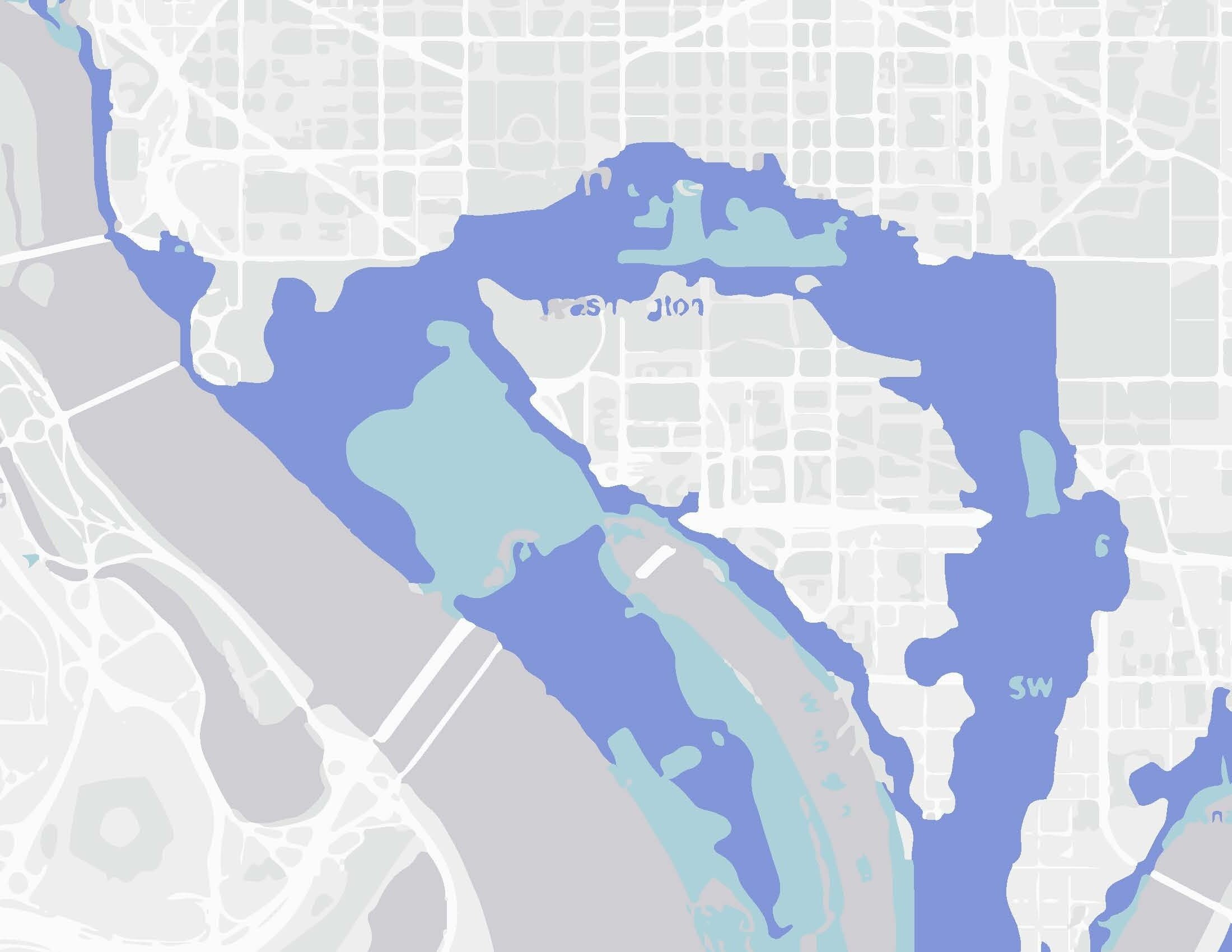
When considering the 50 and 100 year floodplains, from the White House to Capital Building, the entirety of the National Mall are at risk even without considering the impact sea level rise would have on the area.
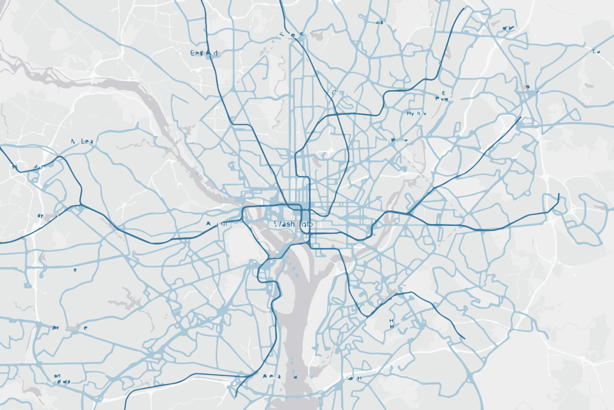
Bus & Train Lines
Although public transportation may not be as pertinent of a concern as the city drowning, DC severely lacks infrastructure to bring both people in from surrounding areas, and once there throughout the city
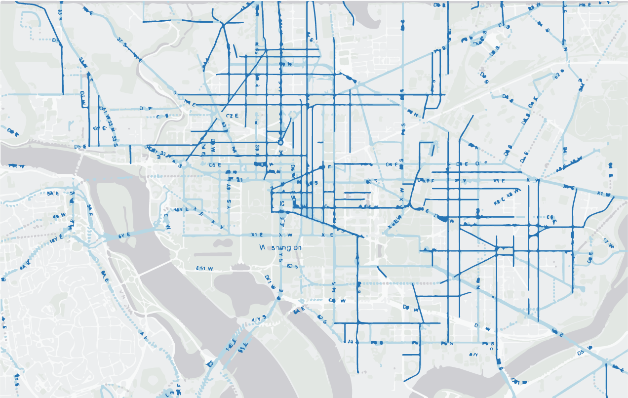
Bike Lanes and Non-motorized Transportation
Evidently monuments are scattered across the city, which renders walking a time consuming and difficult pursuit. While bike lanes are definitely present; they are largely uncoordinated and lack connectivity, especially surrounding the national mall and historical districts
Creating a new experience in a historical landscape, a testament to our future through a harkening to our past
Goal 1:
Force interaction and recognition between human and ecological systems
Goal 2:
Returning elements of human scale to a powerful built environment and an overwhelming global issue
Goal 3:
Redefine the experience of the capital with activeness, motion and dynamism as a standard for all US cities
Goal 4:
Create moments between distant existing monuments defined by thriving natural environments and scenery
Re-Envisioning the Urban Street Scape
Existing Condition vs. Proposed Condition
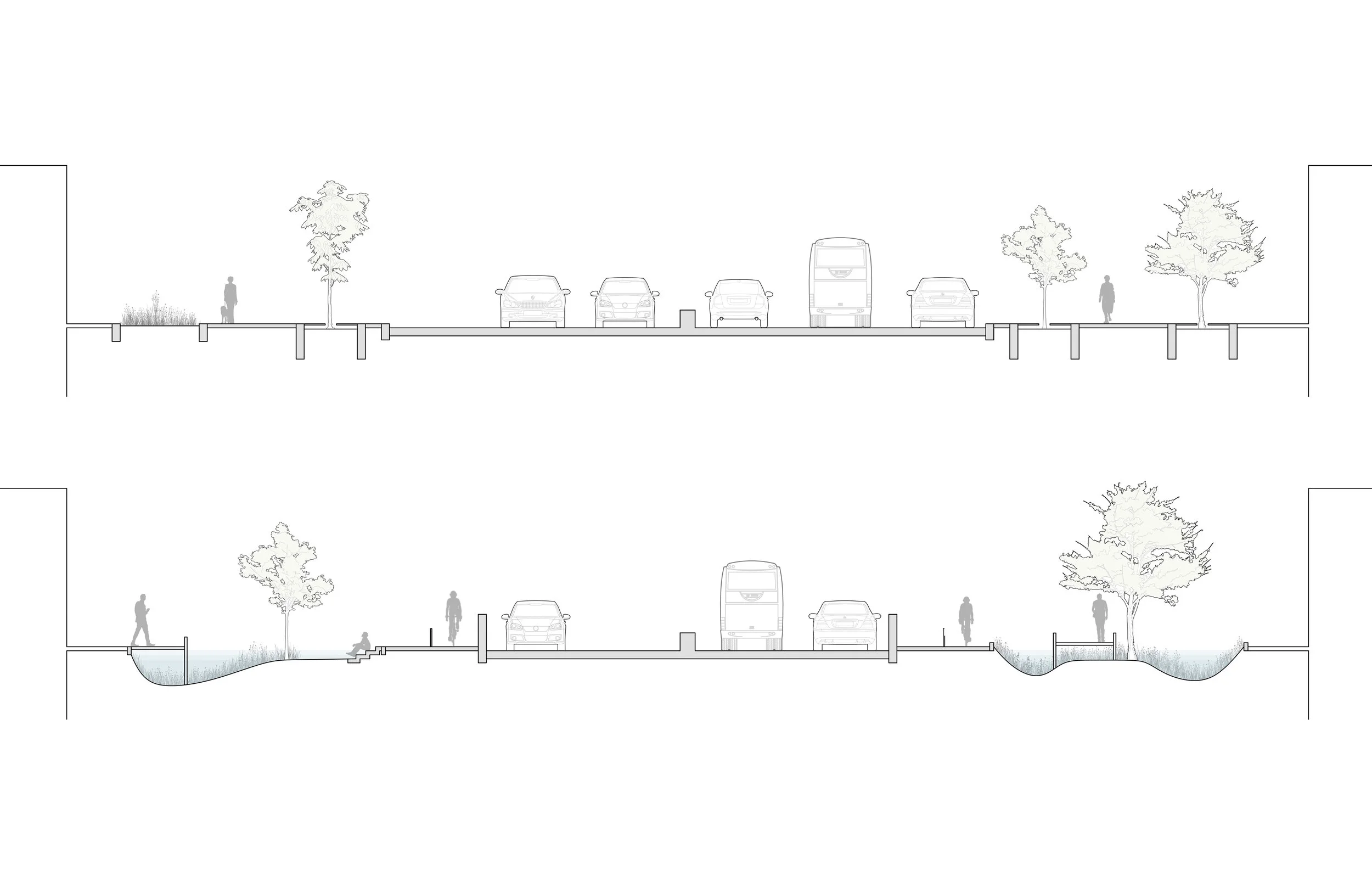
A city wide system is proposed in order to facilitate the flooding resulting from sea level rise by replacing a lane of traffic with large bio-swales, water can be removed from the Tidal Basin and conveyed to a hierarchical network of streets throughout the city
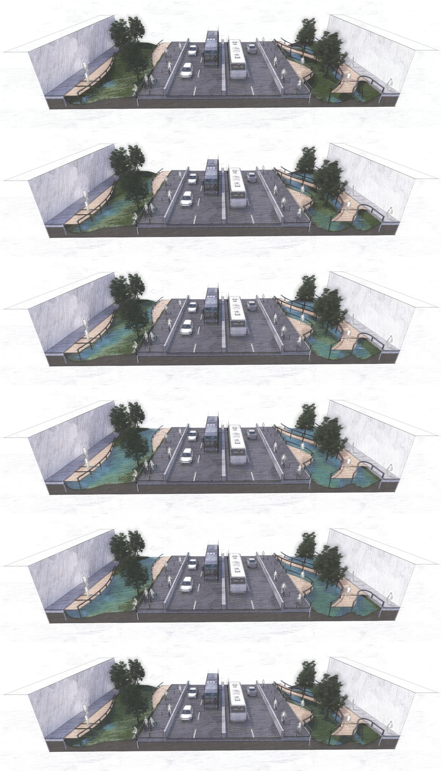
Allows for the filtration of flood water
Permeability is increased from ~20% to 45% on the average streetscape, allowing storm and flood water to be filtered through plant life.
Promotes a comprehensive ecological approach
Creates extensive root structures and robust ecology in an urban environment, moving away from the status quo of planter boxes and tree wells.
Increases resilience to sea level rise
Creates an interactive experience with a global issue in which coexistence is defining of everyday routine, all the while serving as a reminder of the inevitable future.
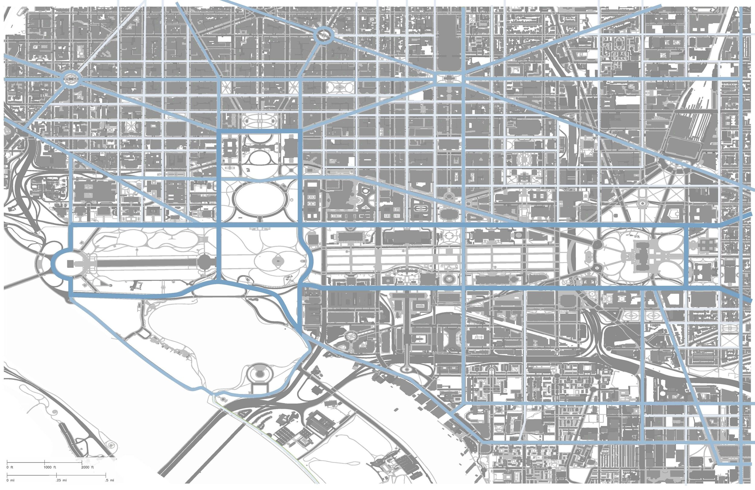
The system directs prioritizes the Tidal Basin & National Mall, then follows a hierarchy based on flood protection priority
Dark Blue - Primary; Protects areas of aesthetic and historic value and encourages pathfinding between monuments
Blue - Secondary; Deals with overflow from primary, graded to South East
Light Blue - Tertiary; Distributes through neighborhoods and directs exit flow back into Potomac River, graded to South
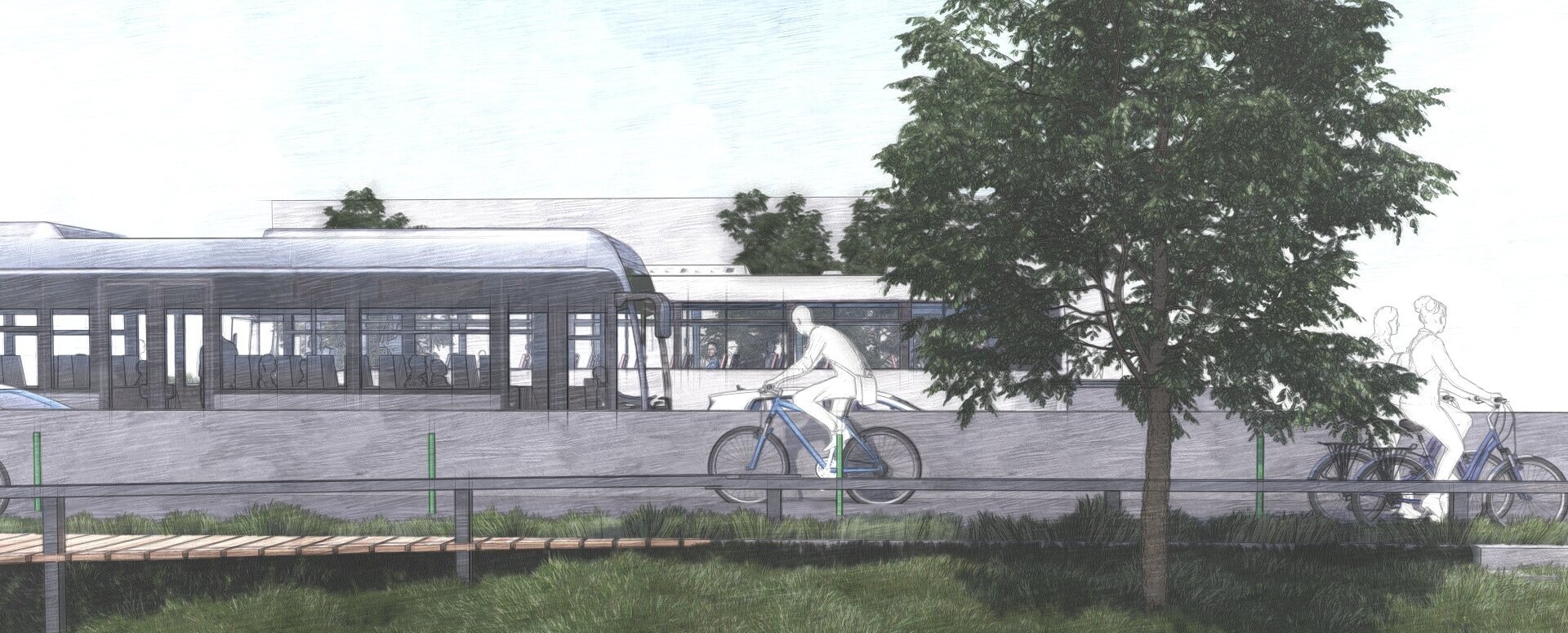
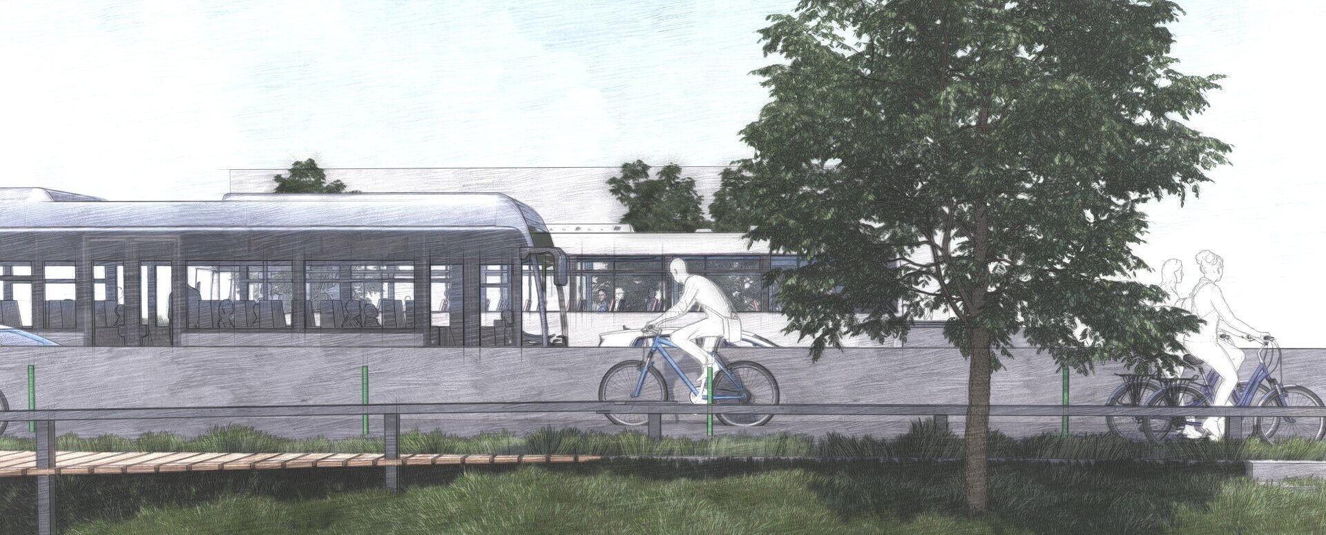
In order to offset the traffic fluidity lost in the removal of a lane, alternative forms of transportation must be systematically promoted
The installation of double wide bike lanes on either side of the road would encourage city wide commuting by bicycle, augmenting the accessibility of historical sites and redefining the experience of the US capital with motion, activeness, and ultimately equality. By encouraging alternate modes of travel through public transportation infrastructure, a profound socioeconomic effect can be fostered where a social platform is created between all classes; the doctor and the bus boy now both ride bikes to work. Not to mention how the inherent activeness in alternate forms of transportation addresses public health issues in a very approachable way.
Tidal Basin Rehabilitation
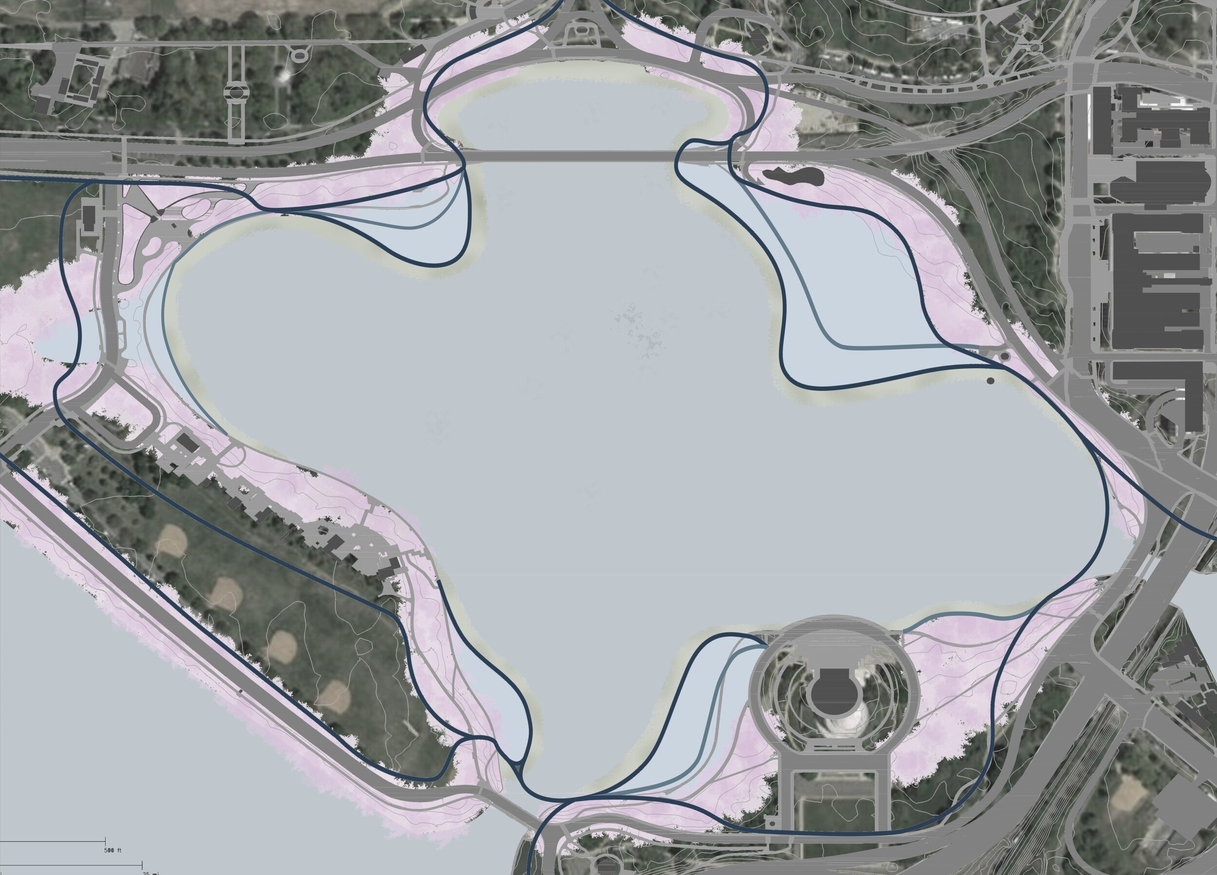
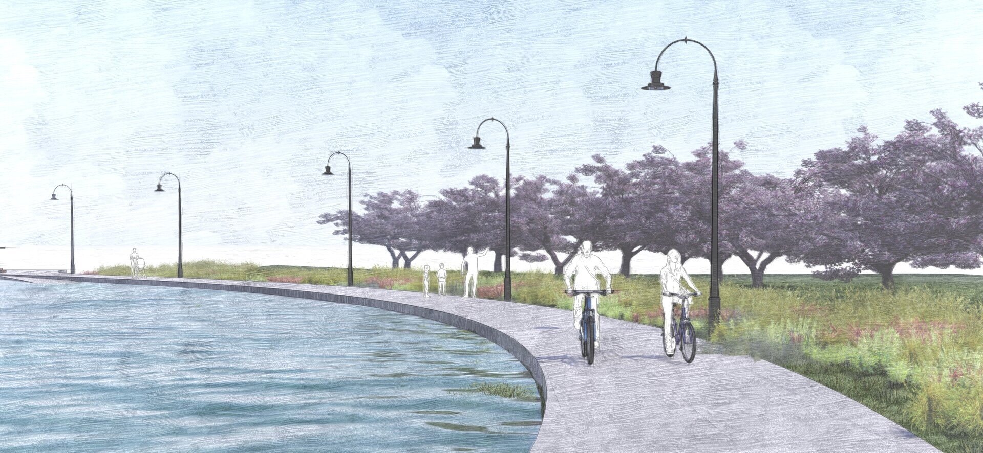
By developing a cohesive primary and secondary circulation around the Tidal Basin and further connecting to the National Mall, the experience between historical sites becomes unified and intrinsically tied to each other through an ecological system. Similarly, the new paths allow for the creation of tidal areas, where berms extend into the existing basin providing areas for flood water to be directed into, and in turn piped into the city-wide street network.
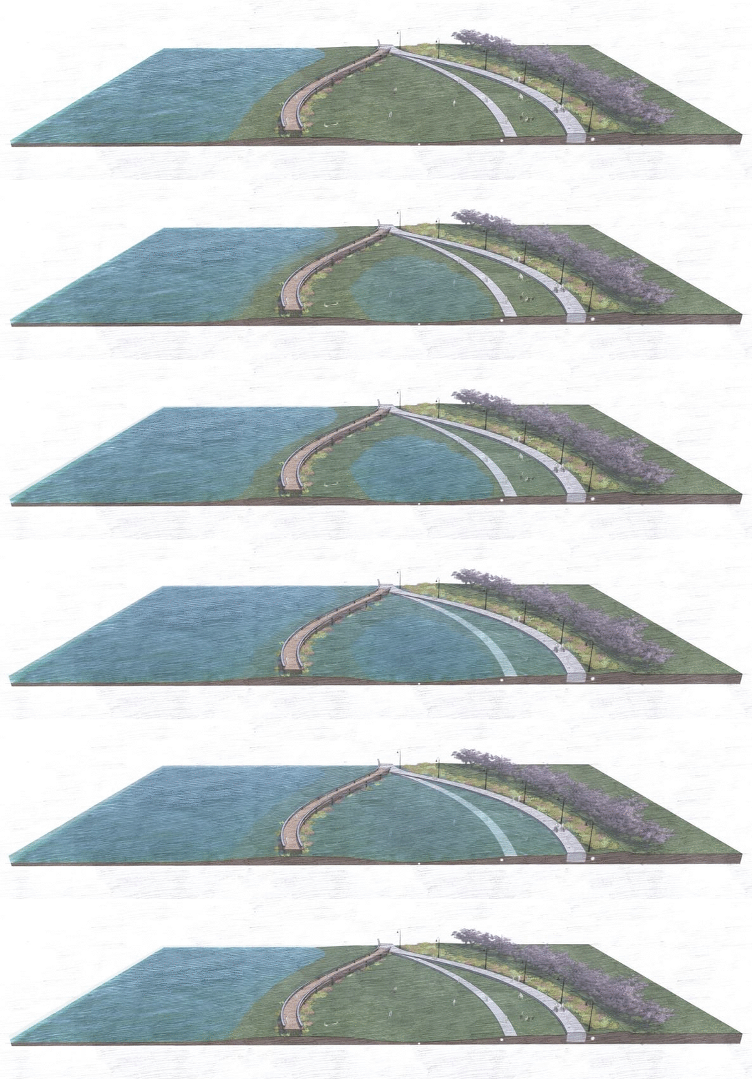
Creation of Tidal Areas
Beyond serving as a catchment basin for flood water intake, the tidal areas further establish the motif of coexisting with natural cycles that is proposed throughout the city. During low tide, the areas serve a recreational purpose, but as the tide comes in the areas become unusable, and in turn redefines the shape and use of the tidal basin based on a newfound connection to ecological systems.
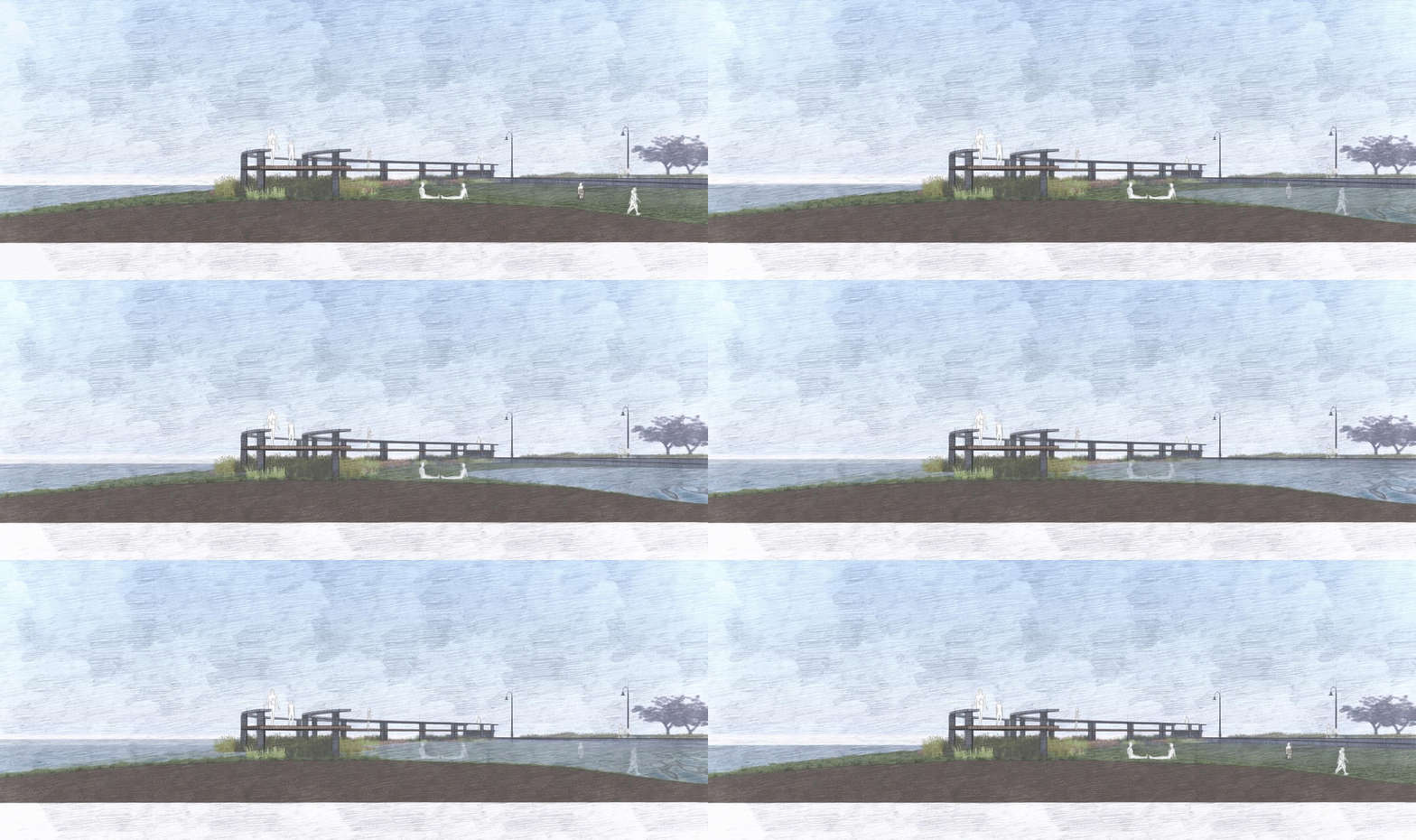
Boardwalk Features
Re-establishment of shoreline condition
Hydric plantings for flood water filtration and increased soil structure
Creation of dynamic recreation area
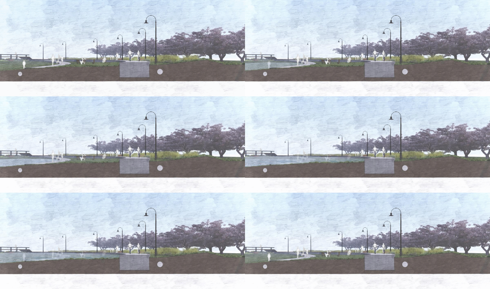
Basin Edge Features
Secondary circulation becomes inundated with tide
Softened Edge
Sea wall repurposed for primary circulation
Berm and out-pipe for flood damage mitigation and physical barrier for the cherry trees